Boyonabike!

Life beyond the automobile in Southern California

Archive for the tag “Pasadena bike plan”

Sierra Madre Villa Bike Lanes

When local governments do little to make their cities bike and pedestrian friendly, I have often been quick to criticize. Sometimes I do a lot of criticizing, because so much still needs to change to enable the transition to a healthier, safer, more sustainable, more equitable transportation system.  But when cities do the right thing, as Pasadena did last week, I want to give credit where it’s due and offer fulsome praise in the hopes that it encourages additional positive steps. Sometimes both happen at the same time, and thus my praise will be tempered with some constructive criticism.

The good:

Pasadena recently painted new buffered bike lanes on Sierra Madre Villa in east Pasadena between Foothill and Orange Grove north of the Gold Line Station. This road diet improves safety along a notorious stretch of road, and provides buffered space for cyclists to ride to and from the retail and residential zones to the north of the station.  Some may recall that this blog has called for a road diet on this street, so it is nice to see the city make this street safer for all.

This safety improvement is especially important with the Metro Bike bikeshare program set to expand into Pasadena.  The retail area is still way too car-centric and these lanes abruptly end at Foothill and Orange Grove, limiting their usefulness for those who might not feel confident riding on those busy surrounding streets, but it is most definitely a step in the right direction, and Pasadena DOT and Councilmember Gene Masuda are to be complimented for their support for this project.

Southbound Sierra Madre Villa south of Orange Grove.

Northbound Sierra Madre Villa, north of Foothill Bl.


If bike lanes are extended north to Sierra Madre Blvd and South to Colorado Bl. extended east and west on Orange Grove and Rosemead Bl., a network of bike-friendly streets would exist for the first time in east Pasadena. Once this happens, the area would become bikeable not only for self-identified “cyclists,” but for everyone.  There is much latent demand for bike friendly streets in east Pasadena. There are parks, schools, offices, and a major shopping/dining area nearby. With the eventual addition of more transit-oriented development (TOD) around the Sierra Madre Villa Gold Line Station, the demand for walkable, bikeable streets in this part of Pasadena will likely grow.

The Bad:

Despite improvements such as Sierra Madre Villa, Pasadena still lacks a connected network of bike-friendly streets. Riding on N. Hill in central Pasadena recently (see photo), within the space of two blocks I was aggressively passed by two motorists, one of whom impatiently honked at me for good measure. I was legally riding on the right half of the right-hand lane, but there is no bike infrastructure on north-south streets in this part of town, and the low-level aggression from motorists makes the experience unpleasant for anyone on a bike.

N. Hill, Pasadena. Parked cars on the shoulder forced me to ride the right-hand lane.


I brushed the incidents off as a “normal” part of riding in the city (I even gave the honking motorist a friendly wave), but the city cannot expect most people to feel comfortable on streets where they may be subject at any moment to vehicular harassment—or worse. The only way to accomplish this is to create a contiguous network of complete streets, well marked and intuitive to follow. This network must allow people to get to desirable destinations safely on foot or by bike.

Yes, education, encouragement, and enforcement are elements of a bike-friendly city, and I don’t suggest ignoring those, but the contrast between the streets with and without bike lanes shows there is no substitute for bike and pedestrian friendly infrastructure. In short, good things are happening in Pasadena, but we still have a way to go before city officials can claim city streets are “bike friendly.”


Dangerous Drivers, Dangerous Roads

Approximate spot where driver cut me off

Approximate spot where driver cut me off

This morning I was on my way back from my ride to my daughter’s school, about to stop off at the local Trader Joe’s to pick up some groceries.  I was on a four-lane stretch of road that is clearly marked as a “Bike Route” (see photo).  I took control of the right-hand lane as state law allows, because the shoulder was intermittently occupied by parked cars and trash bins and the lane was not wide enough for a car to safely pass (In compliance with CVC 21202, sec a3-4).  It was daylight on a sunny day and I had my rear flasher on for safety.  Visibility was not a problem.
As I approached the intersection, I could see a white mini-van gaining on me in my rear view mirror. At the last minute he passed dangerously close to me and then swerved back into my lane, cutting me off with about a foot to spare (violating CVC 21760).  It was a straight intimidation move, designed to send a message that I don’t belong on his roads.  His life-threatening driving got him to a red light at the intersection literally 2-3 seconds earlier than he otherwise would have.  He was a white male about 65-70 years of age with his wife in the passenger seat next to him.  When I got to the intersection, I pulled up to the passenger side of his car and matter-of-factly said that he needed to give me three feet (I may have been talking loudly, because his window was initially closed, but I was not being hostile, despite the fact that he had nearly killed me and my adrenaline–not to mention my anger–were running high). As I explained the law, he rolled down the window and told me that I was “in the middle of the street,” and that I have to “get over to the side of the road.”  I tried to explain that there were parked cars and trash cans that prevented me from doing so, and he growled “fuck you, asshole” and then immediately sped off when the light turned green.  His intimidation tactic won’t keep me off my bike, but drivers like him are an effective deterrent to many more people riding their bikes for everyday transportation.  Until we protect bicyclists from motorists like him, we won’t see significant changes in mode share.
It’s sobering to think there are motorists, licensed to drive by the state, who don’t know the law and would kill you to save themselves the trouble of easing their foot off the gas for a few seconds.  When I got to Trader Joe’s, my legs were wobbly from the realization of how close I had come to serious injury or death because of someone’s reckless, ignorant, entitled operation of a motor vehicle—a potentially deadly weapon.  Moreover, I’ve had another close call in the bike lane less than half a block from that spot.  The streets in that part of Pasadena are dangerous for cyclists because of high traffic speeds and a lack of good bike infrastructure.  The City of Pasadena needs to make it safer for bikes, but I’m sure DOT staff get tired of hearing me complain.
Will they wait until I, or someone else, get killed before acting?

2016 Highlights

As 2016 comes to a close, it’s time for taking stock of the year’s developments in car-free transportation in the San Gabriel Valley.

Arcadia Gold Line station.

Arcadia Gold Line station.

At the top of my list is the opening of the Gold Line extension from Pasadena to Azusa.  This brought the Gold Line closer to my house, and allows me to take the train for part of my commute to work at Cal Poly Pomona.  The rest of the trip is on Foothill Transit‘s extensive bus service in the east San Gabriel Valley.  The Foothill Transit 280 and 486 buses run every 15 minutes during peak times, and their new buses are quite comfortable.  The new commute cuts about 15 minutes off my old route through El Monte Bus Station and allows me to bypass the infrequent service of the Metro 487 bus line.  The bike portion of my new commute is also shorter, which makes it more manageable on a regular basis. The easy bike ride to/from the Gold Line now allows me to get around car-free much more easily.  I’ve been heartened by the ridership I’ve seen–including many more people doing multimodal bike-transit commuting east of Pasadena.

Cal Poly bus stop before and after.

Cal Poly bus stop before (top) and after (bottom).

busstop2

New bus shelters at Cal Poly Pomona.  For too long, Cal Poly’s bus stops on Temple Ave. provided no shelter and little more than a splintered old bench for bus riders (see pictures).  As a result of student activism and new campus leadership, there are two new bus shelters at the main campus bus stops on Temple Ave.  This is certainly a step in the right direction and I’m modestly hopeful for additional progress on transit and bike access to campus.

Thanks to the work of many local advocates, progress toward new bike plans have been made in Pasadena, Monrovia, and La Verne.  With better infrastructure, I’m confident we’ll see an uptick in bike ridership, which in turn should lead to even more bike infrastructure in the future.  Despite these small victories, the pace of change in the SGV is so slow and incremental that it barely registers today. Too many streets are unsafe for cycling and too many destinations are hard to get to by bike and when you arrive, they often lack basic bike amenities like bike racks.  It’s easy to feel angry about the lack of good bike infrastructure that places people at risk and deters others from riding in the SGV, but there are good people working to change this, and they must be given due credit.  The advocates at BikeSGV, for example, have done some wonderful work organizing community rides, setting up the Bike Education Center in El Monte, advocating for complete streets, and bringing a multi-city open streets event to the SGV.  They honored me this past year with an award for my bike advocacy, an award for which I was hardly worthy, but profoundly honored, nonetheless.  I draw hope and inspiration from these fellow advocates.

More protected bike lanes, like this one in Santa Monica, are needed in the SGV.

More protected bike lanes, like this one in Santa Monica, are needed in the SGV.

Education and outreach.  In 2016 I was involved in an alternative transportation project at my daughter’s high school and an alternative transportation conference at Cal Poly Pomona. I also was privileged to speak on “cycling and social justice” to a group of inmates in a Prison Education Project at the invitation of one of my fantastic colleagues at Cal Poly, political science professor Dr. Renford Reese.  In general, I found many of the people I spoke to open to the message of bicycling, walking, and transit for healthier communities. Spreading the message of the many benefits of car-free alternatives was deeply gratifying.

Scott Schultz of BUSted Los Angeles speaks to students at Cal Poly's alternative transportation conference in November.

Scott Schultz of BUSted Los Angeles speaks to students at Cal Poly’s alternative transportation conference in November.

Measure M.  The half-cent sales tax for transportation passed in Los Angeles by a healthy margin (approx. 70 percent voted yes).  This will mean expansion of Metro rail, local bus service, and bike and pedestrian infrastructure.  Measure A, a countywide tax for parks, also passed, which means LA County will have funds for turning many of its now-barren flood control channels into “linear parks” with multi-use paths. Such victories give me hope.

Notable Books and Films of 2016:

  • Frackopoly: The Battle for the Future of Energy and the Environment by Winona Hauter. Essential reading for anyone who wants to understand why hydraulic fracturing (“fracking”) of oil and natural gas is neither safe nor a “bridge fuel” to sustainable energy.
  • Routes of Power: Energy and Modern America by Christopher F. Jones.  Technically, came out last year, but it was new to me this year, so I’m including it here.  Jones, an historian at Arizona State University, weaves a fascinating story of how the infrastructure of fossil fuel was created in the United States, and offers a deeper understanding of how energy transitions take place–essential knowledge as we transition away from a carbon economy. His research also underscores the central importance of pipelines for the delivery of fossil fuel and the expansion of the carbon economy, and thus the importance of blocking the construction of new pipelines in the fight for a livable climate and clean water.
  • Street Fight: Handbook for an Urban Revolution by Janette Sadik-Khan.  The lively story of how Sadik-Khan, former transportation commissioner for NYC, overcame opposition and redesigned many of New York’s streets to be more bike and pedestrian friendly.  Essential reading for any alternative transportation advocate.
  • Before the Flood (documentary film) directed by Leonardo DiCaprio.  Surprisingly good climate change documentary that doesn’t let Westerners’ high-consumption lifestyle off the hook.
  • Bikes vs. Cars (documentary film) directed by Fredrik Gertten.  Technically released Dec. 2015, but wasn’t available until this year.  If you want a good primer on why bikes are and must be a key component of sustainable urban transportation as told through the eyes of several bike advocates in cities around the world, this film is for you.

Thought for 2017: Every bike used for transportation is an instrument of peaceful revolution, every car-free trip a step towards a more equitable, sustainable future.

Same Old, Same Old

Resurfaced Sierra Madre Villa, looking south.

Resurfaced Sierra Madre Villa, looking south.

When I see a street resurfaced, especially a street that desperately needs a bike lane, a glimmer of hope stirs within me that maybe, just maybe, the street will be restriped to accommodate bikes.  This foolish glimmer of hope is usually dashed, as the local DOT simply returns the street to the same old, unsafe car-centric design it had before.

Silly me.

Case in point: the recent resurfacing of Sierra Madre Villa Blvd in East Pasadena between Rosemead Blvd and Sierra Madre Blvd.

"Share the Road"

“Share the Road”

The street is marked as a “bike route” with a couple of “share the road” signs, but hardly anybody rides it because automobile speeds average about 40 mph, and it’s designed for automobile speed, not bike or pedestrian safety.  The street would require some minor re-design to accommodate bike lanes, as I’ll demonstrate below, but there is room for them and the street is a good candidate for bike lanes because it would close a gap between nearby streets that have bike lanes and it is the main route connecting the the neighborhood to the nearby Sierra Madre Villa Gold Line transit station.

This station is the major bus and light rail hub in the area, and is slated to be a bike share station when Metro eventually expands its bike share program to Pasadena.  You would think Pasadena DOT would use the resurfacing as an ideal opportunity to redesign the street for multimodal commuting and safety at minimal cost.  But you would be wrong.

On-street parking forces cyclists to "take the lane" in 40mph traffic.

On-street parking forces cyclists to “take the lane” in 40mph traffic.

Sierra Madre Villa Blvd is a north-south arterial that heads up the hill from the Gold Line station to New York Drive in Altadena (which has buffered bike lanes).  As it heads north, it intersects with N. Rosemead Blvd (which has bike lanes) and Sierra Madre Blvd. (which also has bike lanes). Currently, the street has 2 travel lanes in each direction (one 10-foot and 1 12-foot), a 10-foot center turn lane, and 2 10-foot parking lanes on each side.  The southbound side is residential with a library at Rosemead Bl.  The northbound side has an LDS church and an apartment complex, both of which have ample off-street parking.  The northbound side is the most critical for some kind of bike lane, because of the large speed differential between 40mph cars and bicycles heading up the hill.

Below I lay out the current configuration, then offer two alternatives: one that removes on-street parking from the northbound side and provides buffered bike lanes in both directions (option 1), and another that keeps on-street parking but narrows the parking lane and one of the 12-foot travel lanes to provide sharrows on the downhill side and a bike lane on the northbound side (option 2).  Neither one of these options would have been cost prohibitive.

SMV Current

SMV option1

SMV option 2

Why didn’t DOT consider more bike friendly alternatives for Sierra Madre Villa, especially considering their stated desire for Pasadena to rival Long Beach for bike friendliness?  I have several theories, but one is that DOT staff tends to pay more attention to bike infrastructure in the gentrifying downtown area than in East Pasadena, a less glamorous part of town.

It’s a shame, because this was a real missed opportunity.  DOT needs to know that people on bikes in East Pasadena deserve safer streets, too.

Pasadena Mayoral Runoff

Pasadena voters will decide on April 21 whether Vice-Mayor and Councilmember Jacque Robinson or Councilmember Terry Tornek will be the new Mayor.  With an ambitious new mobility plan expected to come before the Council in the Mayor’s next term, I wanted to get a sense of which candidate would provide stronger leadership for the plan and which would be more likely to support sustainable transportation and walkable, bikeable, neighborhoods.

While there are a number of important issues in the campaign, a lot is at stake for those who walk, bike, and/or use transit in Pasadena—and for those who’d like to, but are intimidated by the idea of riding a bike in traffic.  My family and I regularly bike, walk, and use transit in Pasadena, so installation of better bike infrastructure is very important to me.  As the “Crown City” goes, so goes much of the San Gabriel Valley, thus the election of a bike-friendly mayor has regional implications, too.

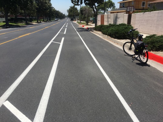
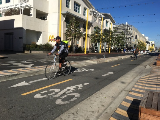
Pasadena is in dire need of a bold new bike plan—and that plan must be implemented sooner, not later.  Anyone who rides here knows that Pasadena’s bike infrastructure is at least 20 years out-of-date, and Pasadena’s deadly streets have been the cause of several deaths in recent years, such as that of Phillip O’Neill in 2013.  And while the city benefits from good transit, with numerous Gold Line stations, Metro, Foothill Transit and ARTS bus lines, transit users who wish to use a bike for “first mile/last mile” transportation will find very little in the way of bike infrastructure.  The city lacks virtually any street that incorporates the latest designs in protected or buffered bike lanes that other cities have been installing.  It’s a shame, too, because Pasadena has such potential to be a bike-friendly city.  Pasadena’s draft bike plan, while far from perfect, is a good first step toward remedying this, but there will undoubtedly be pushback from car-oriented residents and it is imperative that the next Mayor possesses the vision and political courage to withstand the pushback.

A good place to start an assessment of the two candidates is with their responses to the Pasadena Complete Streets Coalition survey on issues such as bicycle and pedestrian safety, which both Tornek and Robinson answered.

Most urgent transportation needs:  On the question of the city’s most urgent transportation needs, Tornek cites “traffic calming” and “protected bike lanes” as the main elements of improving roadway safety and he specifically mentions Colorado Blvd as a potential “great street” project.  These are excellent ideas.  Unfortunately Tornek’s brief answer left me wanting to know more.  What elements of the complete streets policy should be prioritized?  How would he deal with the notorious timidity and foot-dragging of Pasadena DOT?  What about other streets and road treatments short of protected bike lanes (i.e., bicycle boulevards, greenways, etc.)?  How about bike share and connectivity to transit?

In her answer, Robinson mentions that she supports the mobility plan, but she specifies an approach focused on “traffic mitigation” to be achieved by “synchronizing lights on thorough fares to encourage movement of traffic.”  Unfortunately, this car-prioritized approach would neither encourage a modal shift from cars nor improve safety for bikes or pedestrians.  Robinson also notes that in her efforts to revitalize the Lincoln Ave. corridor she has “pushed for a traffic diet [road diet?] to narrow the street in certain sections and slow traffic to encourage walkability and make the area safe for bikers and pedestrians.”

While Colorado Blvd. includes protected bike lanes as part of the proposed bike plan, Lincoln Ave. does not.  A road diet that would significantly slow automobile traffic on Lincoln would be welcome, but without any plan for bike infrastructure on Lincoln it is difficult to see how it becomes “safe for bikers,” let alone how it would encourage others (i.e., schoolchildren, families, commuters) to ride Lincoln Ave.  And, note to candidates: if you don’t want to appear out-of-touch or downright hostile to the cycling community it’s best to avoid the term “bikers.”  Bikers wear leather jackets and ride Harley-Davidsons.

Advantage: Tornek.

Reducing Pasadena’s carbon footprint:  Robinson prefaces her answer with the claim that Pasadenans are “very dependent” on their cars and says residents would drive less only after transit alternatives “become more frequent and efficient.”  I’m certainly supportive of more frequent transit service, but without a concrete proposal for more frequent transit and a plan to fund it, this answer looks like an excuse to maintain a status quo of continued car dependency.  Tornek says he supports “mixed use development and high density housing in appropriate locations,” which have been shown to reduce a city’s carbon footprint by promoting more walking, bicycling and transit use, especially when located near transit.

Advantage: Tornek.

Safe Routes to School:  Asked what they would do to promote active safe walking and bicycling to schools, both candidates say they would promote neighborhood schools . . . (cue crickets chirping).

This partial answer by both candidates ignores the fact that neighborhood schools in PUSD already suffer from very low levels of walking and bicycling to school.  Simply encouraging families to attend neighborhood schools without following through with infrastructure improvements, safety programs and walk/bike to school programs will fail to change this.  The problem is not primarily distance, it is lack of bike infrastructure leading to/from schools.

Here was an opportunity for both candidates to knock one out of the park, to promote local schools AND Safe Routes to School programs AND safer sidewalks AND better bike infrastructure near schools.  Encouraging active transportation for our youth is a no-brainer, instead we’ll continue to suffer from the same unsafe car-choked streets around schools twice daily, continuation of the obesity epidemic (along with much hand-wringing about how our kids don’t get enough exercise), air pollution, stressed-out parents, and another generation that thinks it’s “normal” to be chauffeured in an SUV a mile and a half to school every day.

Advantage: Neither.

Reducing collisions between cars/bicycles (“vision zero”):   Robinson emphasizes “a bike safety initiative to help drivers and cyclist [sic] better understand how to co-exist on the roads together.” Good answer.  However, Robinson’s answer says nothing about the problem of infrastructure.  While I’m not opposed to bike safety programs, anyone who’s ridden a bike on the streets of Pasadena knows the main problem is a lack of safe infrastructure for people on bikes (a result of streets primarily designed for rapid “movement of traffic”).  For his part, Tornek answered that the city should “provide protected bike lanes wherever possible.”  I love the idea of protected bike lanes, but where are the specifics?  And, since even in my wildest dreams we’re not realistically going to have protected bike lanes on every street any time in the near future, shouldn’t bike (and driver) safety also be mentioned?  What about road treatments short of protected bike lanes?  What about a citywide safety program for youth and adults?  Stepped-up enforcement of traffic violations?  We need a network of infrastructure improvements, safety education programs, and enforcement.  Unfortunately, neither candidate really gets this one.

Advantage: Neither.

Riding a bike:  This may seem like a small thing, but it’s not.  There’s no way around it:  riding the streets of your city gives you a significantly different perspective on traffic and road safety than one behind the wheel of a car.  Having a mayor who understands what it’s like to ride a bike makes a huge difference.  Neither candidate, to my knowledge, rides a bike regularly, but even riding occasionally broadens one’s perception about streets.  Last year, PasCSC did outreach to all members of the city council, inviting them to schedule an organized ride in their individual districts.  Such events offer a concrete opportunity to see and feel how the streets work (or fail to work) for pedestrians and cyclists.  It’s something that cannot be fully understood from behind the wheel of an automobile.  Tornek went on a district ride with PCSC.  Robinson expressed interest, but was unable to fit it into her schedule or send a staffer.  I’d feel better about Robinson if she’d made the effort to actually get on a bike with PCSC volunteers and see what the streets in her district are like from a bicyclist’s perspective, as Tornek did.  It makes a difference.  Former LA Mayor Antonio Villaraigosa was not thought of as a pro-complete streets Mayor until he was knocked off his bike by a cab driver while on a ride and saw the serious need for better bike infrastructure.  In other words, actually riding a bike in the city can wake a person up to the serious need for specific infrastructure changes like protected bike lanes.

Advantage: Tornek.

Websites:  What do the websites of the two candidates tell complete streets voters?  Robinson’s website has no section dedicated to complete streets, but on a statement about development promises to “increase pedestrian and public transportation options with areas south of the [210] freeway.”

Tornek’s website includes a more specific statement about complete streets as part of his issues page regarding “reducing traffic and increasing walkability” in Pasadena:

Pasadena needs wider sidewalks and more welcoming public spaces. As Mayor, I will prioritize reducing neighborhood traffic while increasing the walkability of out [sic] streets and making them more bicycle friendly. I believe streets are for people to walk, bike and ride transit…not just drive cars.

Advantage: Tornek.

Debate 1:  What have the candidates said about complete streets and/or active transportation in the two debates they’ve had?  During the first debate, moderated by Star-News editors Larry Wilson and Frank Girardot, the only transportation-related question was regarding the proposed 710 freeway tunnel.

Robinson and Tornek both told the debate audiences they opposed the 710 extension.  Robinson specifically mentioned “alternative modes” of transportation for the route and Tornek said the tunnel would be expensive and the route would soon be every bit as congested as it currently is (see the 405, for example).  Of course, they are both correct.  The well-documented phenomenon of “induced demand” or “latent demand” will mean that the 710 route will soon fill up with cars, solving nothing, and the only real long-term solution is transit—either light rail, or real BRT.

Unfortunately, during the debate neither candidate took the opportunity to tout the benefits of complete streets as part of a well-rounded social and environmental policy.  On questions about the city’s economic situation, for example, they might have brought up the ways walkable, bikeable streets have been shown to benefit local businesses, but neither did.  When asked about local schools, they could have mentioned how encouraging walking and bicycling to school through programs like Safe Routes to School (SRTS) benefits students’ health, improves safety, reduces traffic congestion around schools, and has even been shown to improve test scores, but they didn’t.  They might have mentioned the benefits of active transportation to overall public health and lower healthcare costs, but they didn’t.  When addressing the needs of the city’s low income residents, they ought to have discussed how redesigning our streets for alternative modes of mobility can foster social equity, but they didn’t.

Advantage: Neither.

Debate 2:  During the second debate, hosted by KPCC’s Larry Mantle, candidates were asked what they would do to promote complete streets and improve safety for bicyclists and pedestrians.  Robinson explicitly said she supports the bike master plan and the Pasadena Complete Streets Coalition’s efforts to “educate the public” that roads should be multimodal.  However, when Mantle pressed her on whether she still supported a road diet for Colorado Blvd., even if it meant, in Mantle’s words, “losing a lane of traffic,” she hedged.  “Yes,” she answered, “provided that we have the complete information.”  She said the Council would need to be “mindful that it [a road diet] may not always have a positive impact.”

Unfortunately, I thought both the question and the answer reflected a singular windshield perspective.  Yes, there’s an adjustment at first, but (a) road diets don’t cause roads to “lose” a lane, they repurpose a travel lane in a way that will encourage a transportation mode shift and provide protection for vulnerable road users who already use the streets; and (b) there are a wide variety of long-term positive impacts that far outweigh any temporary inconvenience to motorists.

When Mantle pressed her about her “qualms” on the road diet, a centerpiece of the draft bike master plan, Robinson backpedalled further.  The road diet, she said, “is something we should consider.”  She then explained:

When you remove a lane … the number of cars is not going to go anywhere so there’s either going to be more cars traveling on the street in a single lane, which will create more traffic, or they’re going to move to other streets, so we have to be mindful of that as we move to these new ideas.

The answer raises a troubling question in my mind about whether she’d actually vote for the road diet (rather than just “consider” it) let alone whether she’d have the determination to defend it when opposition arises.  Moreover, road diets don’t “create more traffic.”  They may shift it, they may slow it (not necessarily a bad thing from a safety perspective), and they may actually reduce it if alternative modes of travel are convenient and safe.  Blaming bike lanes or road diets for “creating” traffic reflects a narrow windshield perspective.

Tornek noted that everyone says they support multimodal transportation, “until you actually have to remove a lane.”  He reiterated his support for the road diet and parklets on Colorado Bl., despite the “great resistance” he anticipates this will initially generate.  The complete streets concept, he said, is now state law, and it forces cities to come to grips with the reality that streets are not just for cars.  “All of us,” he continued, “will learn to view the way our streets operate in a different way.”  As for the Colorado Blvd. road diet and its effect on traffic, he cited the DOT’s data that showed only a 2% reduction in travel speed for cars, and noted that there is capacity on adjacent streets and “if it’s not going to work there [on Colorado Blvd.] it won’t work anywhere.”

Advantage: Tornek.

Conclusion:

Both candidates appear to support the city’s draft bike plan, but voting for the plan when it comes before council and implementing road diets and bike lanes are two different things.  I get the impression from the second debate that Tornek would be more likely to follow through on the latter, even in the face of opposition.  When pressed on the more ambitious specifics of the bike plan in the second debate, Robinson’s support wavered.  Contrast it with her unequivocal (and admirable) support for raising the minimum wage, which she said she’d support even if some local merchants were opposed.  She offers no specifics about bike lanes and sometimes betrays an uncritical windshield perspective on traffic and safety issues.

There is much I like about Robinson, such as her support for public schools, her work on the Lincoln corridor, and her advocacy of a higher minimum wage.  It would be inspirational and historic for Pasadenans to elect a woman, a person of color, and a product of Pasadena’s public schools to the highest office of this staid old city.  That said, her positions on complete streets issues tend to reflect a cars-first mentality.  Even when she says she supports an element of the bike plan, she almost always hedges her answer.  This is especially disappointing since she represents a district where a relatively higher proportion of low-income residents rely on walking, bicycling, and transit for transportation.  One wishes she had been able to find time to go on a ride or walk in her district to see what her constituents on bicycles or on foot experience every day.  Her answers on the Complete Streets survey were not as strong as Tornek’s and her apparent waffling on the Colorado road diet during the second debate was also extremely disappointing.

On the other hand, on his website and in the second debate, Tornek offers explicit support for specific infrastructure improvements such as protected bike lanes that we need on our streets.  His answers in the second debate suggest he’s willing to support the proposed road diet on Colorado Blvd. even when opposition arises.  His answers demonstrate a bit more insight into the way mobility choices can be reconfigured when infrastructure and development patterns are steered in that direction.  On the City Council, Tornek, along with Councilmember McAustin, was instrumental in getting Pasadena DOT to revise and strengthen its draft bike plan last year and he made the time to go on an exploratory ride in his district.

Shifting away from car dependency is not going to be easy, but, aside from health and safety concerns, the issue is critically important as we face an unprecedented crisis of climate change.  We need to think anew about transportation planning, especially in urban areas.  We must view our streets differently to meet different transportation needs for the 21st century and shift our priorities accordingly.  Fortunately, shifting to transportation alternatives brings with it a variety of added benefits for the economy, public safety, and public health.

Pasadena, like the rest of our society, cannot afford to waste more time.  Bold leadership is required, as is the willingness to stand up to the inevitable resistance to change.  Pasadena needs a mayor who thinks of streets in terms of moving people, not just moving cars.  Though I’m somewhat disappointed in the brevity of some of Tornek’s answers on the PCSC survey and I have some minor reservations, for the most part he seems to get it.  His answers on the issues and his strong performance in the second debate suggest he is more likely to help the Council approve the new bike plan and its timely implementation.  For these reasons, I would recommend a vote for Tornek.

So, I encourage Pasadenans to read the Complete Streets survey, read the candidates’ websites and view the debates, and make up your own minds.  But by all means please “bike the vote” on April 21.  I also recognize that the work is just beginning.  Those who want complete streets in Pasadena must continue to organize, speak out, and vigorously press the city’s leaders and staff to follow through with a bold vision for sustainable, equitable, safe, and people-friendly streets … regardless of who wins on election day.

East Pasadena Exploratory Ride

Noreen Sullivan (2nd from left) joins members of the Pasadena Complete Streets Coalition on a District 4 exploratory ride.

Noreen Sullivan (2nd from left), field representative for Councilmember Masuda, joins members of the Pasadena Complete Streets Coalition on a District 4 exploratory ride.

Saturday morning members of Pasadena Complete Streets Coalition were joined by Noreen Sullivan, field representative for Pasadena City Councilmember Gene Masuda, on an exploratory ride around Masuda’s District 4 in east Pasadena.  PasCSC has been hosting exploratory rides for council members and their staff around Pasadena in order to raise awareness of the need for better bike infrastructure and build support for a citywide bike plan that addresses these needs.  The rides are an excellent opportunity for city council members to get a first hand idea of the importance of a bike plan and the need for specific improvements.  Nothing does this better than getting on a bicycle and experiencing it for yourself.

PasCSC members embark on their exploratory ride from the Sierra Madre Villa Gold Line station.

PasCSC members embark on their exploratory ride from the Sierra Madre Villa Gold Line station.

Our ride was organized by Candace Seu, an energetic volunteer for PasCSC, and took place on a gorgeous January day.  The ride started off from the Sierra Madre Villa Gold Line Station, and the group discussed the need for better bike access to the station, especially the need for bike lanes on Halstead, the safest bike approach to the station from the north and east.

Ride organizer and PasCSC member Candace Seu photographs motorists encroaching on bike lane on southbound Rosemead at Sierra Madre Villa.  The group also witnessed a motorist illegally cutting off a cyclist on the northbound side of the same intersection. Pasadena DOT, are you listening?

Ride organizer and PasCSC member Candace Seu documents speeding motorists encroaching on bike lane on southbound Rosemead at Sierra Madre Villa. We suggested that DOT needs to install bollards or some other means of keeping autos out of the bike lane.  The group also witnessed a motorist illegally cutting off a cyclist on the northbound side of the same intersection. Pasadena DOT, are you listening?

From Halstead, our group turned left on Rosemead Blvd, which has relatively new bike lanes for one block between Halstead and Sierra Madre Villa.  We proceeded to the corner of Rosemead/Orange Grove and Sierra Madre Villa, which is a dangerous intersection for bicyclists because of design features that encourage high motor vehicle speed and have insufficient protection for cyclists.  I’ve complained about this intersection before.  This intersection includes a right-turn merge lane from north(west)-bound Rosemead Blvd to northbound Sierra Madre Villa.  The traffic was too fast for bicyclists to feel safe because of the road design that prioritizes automobile speed over safety.  Indeed, while discussing the problems of the intersection, we witnessed a cyclist riding in the bike lane get cut off by a right-turning motorist who couldn’t be bothered to slow down for the cyclist.  We suggested to Sullivan that DOT redesign the right turn lane of that intersection and add green paint to the bike lane and signage to enhance motorists’ awareness of the bike lane.  She seemed concerned about the problems of this intersection and promised to share those concerns with Councilmember Masuda.

From there, the group rode west on Paloma street to Craig, Craig to Villa, and Villa back to Sierra Madre Blvd.  This part of the ride went mostly through quiet residential streets that are very pleasant to bike.  People in this neighborhood could easily bike to schools, parks, shops, and the Gold Line, but we stressed that the major streets surrounding the neighborhood connecting to these destinations need better bike infrastructure, otherwise most people won’t feel comfortable or safe bicycling them.

The group subsequently turned left on Sierra Madre Blvd and followed it past the farmers’ market at Victory Park and Pasadena High School then east as it climbs from Eaton wash to Hastings Ranch.  This portion of Sierra Madre Blvd has bike lanes, but as I’ve written before, they are narrow gutter or door zone bike lanes on a street with very fast traffic and wide traffic lanes.  By narrowing those traffic lanes just a bit the city would have space for wider, buffered bike lanes, which would make this stretch of roadway much safer and more comfortable for cyclists.  Since Sierra Madre Blvd is the main route to two high schools (Pasadena H.S. and LaSalle H.S.) and a major city park (Victory Park), safety for young people and families bicycling on this road is a crying need.  We also raised the possibility of a multi use path in the wide median on the boulevard, and this might be a good long-term project, but the buffered bike lanes are something that can and should be done right away.

From Sierra Madre Blvd., we glided down Hastings Ranch Road from and stopped at Rosemead Blvd, where we pointed out that there was room for bike lanes, and perhaps even protected bike lanes (sometimes called “cycle tracks”) on Rosemead Blvd.  We pointed out that Temple City has installed protected bike lanes on the section of Rosemead that runs through it.  Wouldn’t it be great, we said, to have those protected lanes continue into Pasadena?  Yes!

We concluded our tour back to the Gold Line station.  I was pleased that someone from the city council member’s office was able to hear our concerns, and see for herself some of the problems related to car-centric road design in this part of Pasadena.  I was also very pleased that the young people on the ride spoke up and asked for safer bike lanes for cyclists.  At the end of the ride Noreen thanked us for an enjoyable and informative experience and said she would report her observations to Councilmember Masuda.

The draft bike plan for Pasadena has many positive elements–especially for downtown—but east Pasadena is relatively neglected in the plan and I hope Councilmember Masuda will insist on the Pasadena DOT addressing key problem spots in east Pasadena as part of the bike plan.  Among these, the most pressing are the Halstead approach to the Gold Line station, buffered bike lanes on Sierra Madre Blvd, bike lanes on Rosemead Blvd., and the seriously dangerous intersection at Rosemead/Orange Grove and Sierra Madre Villa.

These exploratory bike rides are a wonderful way for city leaders to get out and explore their districts in a way that driving can’t.  In so doing, PasCSC hopes they see the need for prioritizing an ambitious new bike plan and—most importantly—implementing it sooner rather than later.  In so doing, Pasadena would move closer to its potential as a healthy, green, multimodal city.

An End to LOS in Pasadena

Members of Pasadena Complete Streets Coalition pose for a celebratory picture after the City Council voted unanimously to end the city's old car-centric LOS transportation metric. (Photo courtesy PasCSC)

Members of Pasadena Complete Streets Coalition pose for a celebratory picture after the City Council voted unanimously to end the city’s old car-centric LOS transportation metric. (Photo courtesy PasCSC)

On November 3, Pasadena’s City Council voted unanimously to ditch the car-centric measure of mobility called “level of service,” or LOS.  The policy change was developed and proposed by the staff at Pasadena DOT and is a critical element of Pasadena’s efforts to become a more environmentally-friendly city by encouraging multi-modal transportation, and denser, mixed-use development downtown.  Pasadena’s local complete streets advocacy group, Pasadena Complete Streets Coalition (PasCSC), lobbied for this change as a necessary step in making the city’s streets safer and more user-friendly for pedestrians, bicyclists, and transit users.  The state of California is currently reassessing LOS and working on its own statewide multimodal metric, but to my knowledge Pasadena is the first city in Southern California (though certainly not the last) to break from the old LOS standard.

For the policy wonks, LOS was developed by traffic engineers decades ago as a means of measuring the increased automobile traffic that often comes with the growth of cities.  It made sense in an era when cities were being redesigned around the automobile and it was assumed that everyone would—and should—drive.  It makes far less sense when cities are trying to reduce their carbon footprint, automobile pollution, and encourage alternative modes of personal mobility.  Providing for the convenience of automobile mobility as the only measure of transportation quality had the unintended consequence of creating what is known as “induced demand” as wider roads encouraged more driving, more driving begat more auto-centric development, which, under LOS, mandated wider roads, ad infinitum.

One of the downsides of LOS has been that it measured the transportation impact of property development and road use solely by its impact on automobile wait times at intersections.  Put another way, pedestrians, bicyclists, and transit users didn’t count, so their needs usually went unmet under the LOS rubric.  A short wait time for cars at an intersection would, for example, receive an ‘A’ grade, while a longer wait time for cars would receive lower grades.  Pedestrians who had a long wait at a traffic light and then a dash across the street to beat the short crossing signal were not counted under LOS.  A bus with 25 passengers counts as much as a single occupancy automobile under LOS.  A bike lane that might slightly reduce road capacity for automobiles would be D.O.A. under LOS, on the assumption that it might make drivers wait a few seconds longer at a stoplight, triggering a failing LOS grade.  Never mind that more people would be willing to leave their cars at home if they had safe, convenient alternatives, LOS meant drivers, and only drivers, counted.  Moreover, the widening of roads to achieve a good LOS score often resulted in unused road capacity during off-peak hours and has also been shown to induce higher automobile speeds and deadlier collisions.  The ‘S’ in LOS thus stood for service to motorists only, and reflected the domination of streets by cars in the late 20th century.  The new standard reflects the idea that cities should measure the movement of people, not just cars, when judging the impact of development.

The new standard uses a mix of Vehicle Trips (VT) generated, Vehicle Miles Traveled (VMT) per capita, access to alternative modes (walking, biking, transit) of transportation, as well as LOS.  The new measure also provides that mitigation of the traffic impact of development can include funding for alternative modes of transportation, whereas previously a developer would be required to provide more parking or road-widening.  Pasadena DOT staff believe that the new measure provides a fuller picture of the multimodal reality of modern city mobility and give the city the flexibility to encourage multi modality, safety, and sustainability.

Pasadena still has a long way to go to achieve its complete streets vision, but it is gratifying to see the city take one more step toward that vision.

Small Steps?

BikewayStudyMTG

Could the city of Pasadena finally be close to adopting an ambitious mobility plan?  This week, my friends at the Pasadena Complete Streets Coalition (PasCSC) attended meetings with city officials to provide feedback on elements of a new mobility plan that, if implemented, will make getting around Pasadena on foot and by bike much easier and safer.  The first of those meetings was a preview of potential new bikeways in Pasadena.

A year ago, in the wake of the tragic death of cyclist Phillip O’Neill in the city, a group of local advocates met and formed PasCSC to lobby for safer streets for all road users (“complete streets”).  As part of that effort, the group was critical of the Pasadena DOT’s draft mobility plan as not going far enough to make Pasadena bike and pedestrian friendly.  Several members of the City Council, including Mayor Bill Bogaard and Councilmember Terry Tornek, called on DOT to revise its bike plan and “be bold.”

On June 24, community members got a sneak peek at a “Bikeway Analysis and Feasibility Study” that assessed the feasibility of major street redesign on up to seven east-west corridors and four north-south corridors in Pasadena.  The study was conducted by KOA Corporation, a transportation planning and engineering firm that has designed, among other things, the highly regarded 3rd Street and Broadway Cycle Track in Long Beach and the new Rosemead Cycle Track in Temple City, the first of its kind in the San Gabriel Valley.

Temple City's cycletrack on Rosemead Blvd. (photo: StreetsblogLA)

Temple City’s cycletrack on Rosemead Blvd. (photo: StreetsblogLA)


Cycle tracks are essentially bike lanes protected by a physical buffer, such as a curb, landscape planters, or parked cars.  They are common in Europe and have just begun to be used here in the US.  They are, if you’ll excuse the automobile metaphor, the Cadillac of bike lanes.  Rich Dilluvio, senior transportation planner for Pasadena’s DOT (see photo, top), asked the advocates for feedback and to prioritize the proposed routes that would be most valuable to cyclists as the initial backbones of a bike-friendly Pasadena.  Planners wanted to know, in other words, in case they’re not all funded at once, which ones did bicyclists want to be completed first?  I confess, I want them all—now, but I know that it will take time to work its way through the political process, the community outreach process, the funding process, and finally, the construction process.  I also realize they may not all be funded immediately.  The sooner we get them, though, the better for active mobility and traffic safety in Pasadena.

Readers will know that I’ve been critical of Pasadena’s previous bike plan, but my initial response to these new proposed bikeways is cautious optimism.  The east-west routes are especially ambitious, including plans for separated, bi-directional bike lanes on Green and Union, as well as proposed cycle tracks or buffered bike lanes on other routes. The north-south routes are a bit more difficult because they need to be routes that cross the 210 freeway (the huge concrete traffic sewer that cuts through the heart of Pasadena like a jagged gouge carved out of the city’s midsection) and don’t have high traffic volumes.  These constraints limit north-south routes, and they tend to be narrower streets.  For these north-south corridors, KOA Corporation engineers have proposed four “bike boulevards” that will be designed to minimize automobile volume and speed, and prioritize bicycle travel.  Similar treatments have been done on streets in Portland and Minneapolis, two of the most bike-friendly cities in the US.  A pilot for such treatment has also been implemented on Pasadena’s North Marengo Ave. between Orange Grove and Washington.  In addition, DOT director Dilluvio indicated that several existing streets with bike lanes are slated to be repainted with buffered bike lanes when they’re up for resurfacing.  Buffered bike lanes increase a cyclist’s comfort and safety by providing a painted “buffer zone” between the bike lanes and other traffic lanes.

This proposed network of bikeways is not perfect.  Several advocates noted that the planners seem to have paid little attention to modifying intersections.  Most collisions take place at intersections, and less experienced bike riders who feel comfortable in a protected bike lane mid-block will find themselves unprotected when they get to busy intersections.  This may reduce potential ridership, and hence the purpose of the protected bike lane.  Also, there was apparently little effort to choose key corridors that would directly connect with any of the city’s six Metro Gold Line stations, meaning commuters, shoppers, or visitors who take the Gold Line won’t be right next to the best bike routes to and from Gold Line stations.  There are still gaps: Northwest Pasadena and East Pasadena get little attention, though these bikeways are only part of the larger bike plan.  Finally there has, as yet, been little thought given to a system of wayfinding signage to help bicyclists navigate the proposed bike-friendly network of routes through town.  I am hopeful that there will be opportunity to address these issues when the entire bike plan comes up for public comment.

I have to say that these proposed bikeways, if they are funded and constructed, have the potential to be a significant step in the right direction for Pasadena, making the city a leader in active transportation in the San Gabriel Valley.  Soon it will be time for Pasadena’s elected officials to resist the inevitable boo-birds and anti-bike lane NIMBYs who will oppose any change in the current car-centric design of Pasadena’s streets and approve these proposed bikeways.  PasCSC will have to mobilize its supporters to provide support for the plan.  A healthier, safer, greener, even happier city awaits this pending test of community mobilization and city leadership.

A Sea Change

Sometimes it is easy to forget the power of people to bring about change.  But yesterday, the Pasadena Municipal Services Committee responded to pressure brought by the city’s new Complete Streets Coalition and brought the Crown city a step closer to real substantive change in its infrastructure.  The committee rejected the DOT’s current proposed bike plan and called on the city’s DOT to come back with a “more ambitious” plan that relies more on protected bike lanes and cycle tracks than the current plan.  As Council member Terry Tornek put it, “We need to grab a hold of this and not be timid.”

According to Wes Reutimann of the Downtown Pasadena Neighborhood Association (DPNA), Mayor Bogaard and City Council members Tornak and Margaret McAustin, who serve on the Municipal Services Committee were unanimous in support of a bolder plan that would put Pasadena at the forefront of bike-friendliness in Southern California.  They also expressed a willingness to devote resources to getting a new bike plan implemented.  This exciting news comes just a week after a complete streets forum in the city sharply critiqued the lack of safe bike infrastructure in Pasadena and the city’s relatively weak proposed bike plan, and represents, as Reutimann emailed the Complete Streets Coalition listserv, “a literal sea change insofar as bicycling planning/policy in Pasadena is concerned.”

This sea change is good news, and it may be due in part to the formation of the Pasadena Complete Streets Coalition (PasCSC), and certainly is a result of the advocates who showed up at the committee meeting and raised awareness about the need for better bike infrastructure in the city.  Finally, credit is due to Mayor Bogaard and Council members Tornak and McAustin who recognized the shortcomings of the old plan and all of whom spoke strongly in favor of a bold step toward bike-friendliness.

It will be especially important for the CSC to remain vigilant and continue to organize, develop a clear set of priorities, outreach to the community, and develop a long-term communication strategy.  Make no mistake, there will be push-back from some car-dependent sectors of the community, so the CSC will have to be prepared to mobilize people to continue to make the case when the revised plan comes before the City Council in the future.  We’ll have to see the actual revised plan before judging how serious the city is about its commitment to bike-friendliness.  The CSC must make sure the city’s revised plan does not overlook the less glamorous areas of the city, such as Northwest Pasadena and East Pasadena; it must make sure any network of bike lanes provides connectivity to transit nodes, business districts, shopping, parks, and schools; and it must be vigilant that the city is in fact providing sufficient resources to make the entire plan a reality over a reasonable amount of time.

With these caveats in mind, this development is a most welcome bit of news.  I have renewed hope for Pasadena as a city that can take a leadership role in the region’s transportation revolution, in which living beyond the automobile is one step closer to reality for more people.

Something Happening Here

Pasadena Complete Streets Forum discusses Pasadena's Bike Plan.  Photo courtesy DPNA

Pasadena Complete Streets Forum discusses Pasadena’s Bike Plan. Photo courtesy DPNA

When Phillip O’Neill was struck by a motorist and killed while riding his bicycle on Del Mar two weeks ago, a cry of grief went up from Pasadena’s cycling community.  But unlike last year when two cyclists were killed by automobiles in Pasadena, there is a chance that this tragedy has galvanized the community in a way that may bring about change.  In response to the tragedy, a “Complete Streets Forum” attended by upwards of 50 people was held last night at Pasadena Presbyterian Church on Colorado Blvd, and that meeting may be the genesis of a new organization that will push Pasadena officials to move faster to create safe streets for all road users (I say may be, for reasons I’ll explain below).  Participants included many from the DPNA, as well as Caltech and PCC students, quite a few bicycle commuters and recreational riders from the area.

The Forum emerged from an email conversation initiated by Margaret Ho of the Caltech Bike Lab and Wes Reutimann of the Pasadena Downtown Neighborhood Association.  Margaret was the first to call for a meeting to discuss the need for more bike-friendly streets, and Wes worked with the DPNA to host the event at Pasadena Presbyterian Church.  The DPNA, active in livability issues in Downtown Pasadena, brought Rich Dilluvio, chief administrator for the Pasadena DOT, to give an overview of Pasadena’s proposed Bike Plan, which will be voted on by the City Council on July 15.

I have my own critiques of Pasadena’s bike plan, which I’ve written about here, here and here, so I won’t rehash them on this post, but it was clear from the questions to the DOT plan that many in the audience were unsatisfied with the slow pace and unambitious scope of the city’s plan and want improvement to the city’s bike infrastructure beyond the current proposal.  After the Q and A, Dr. Mark Smutny, pastor of PPC and a board member of DPNA, facilitated a strategy session in which attendees broke into small groups and shared ideas.  There were three “rounds” of small group discussion, followed by a sharing of ideas as a whole group.  The small groups allowed everyone a chance to share their views and the whole group discussion distilled the major themes that emerged, providing the group with a vision for where we go from here.

As each group shared its findings, several larger themes became apparent.  First, people are afraid to ride on many of Pasadena’s streets.  They want to ride to school, work, socialize, exercise or run errands, but they’re afraid because of a lack of separated bicycle infrastructure on city streets.  While the city’s proposal relies heavily on “bike routes” and “sharrows,” most people in the group said they wanted cycle tracks, buffered bike lanes, or at the very least clearly marked bike lanes, not class III bike routes.  Second, they are frustrated that the city currently has no dedicated funding for bike infrastructure.  Related to this is the fact that the city currently has no implementation goals aside from a vague goal in the current plan of 10 years or longer if funding is not available.  So the group consensus was that the city has to put its money where its mouth is and fund infrastructure change sooner rather than later, with shorter-term goals and timetables that can be measured.

Finally, there was a consensus that the group needs to organize to make its voice heard by those in power.  Several suggested the formation of a bike/pedestrian safety task force to work with the city’s Police Department on enforcement of traffic safety.  But it is clear to many in the room there is a desperate need to push the city to improve its infrastructure, and that change will not come by itself.  There seemed to be a feeling (that I strongly share)  that we need to organize some sort of group to this end.  It was suggested that the group call itself the Pasadena Complete Streets Coalition, but one participant thought that sounded “too political,” so it was decided that the name of the group would be decided later.

Nevertheless, the tide seems to have turned in Pasadena.  With or without an official title, there is a new organization in Pasadena with energy and with a sense of purpose advocating complete streets as part of a livable, sustainable city.  The group’s next mission is to develop a series of talking points and make our voices heard at the July 15 City Council meeting.  But if real change is going to happen, the group will need to mobilize a wide range of grass roots constituencies in and around the city, develop an effective communication strategy, and organize to put sustained pressure on elected officials.  If the group does these things, Pasadena could be poised to be the next great walkable, bikeable city in Southern California.

To put your name on the email list for the Pasadena Complete Streets Coalition, please go to the DPNA website here.

Post Navigation